The VOS Climate Project - The Way AheadSarah C. North, MET Office (UK) - VOSClim Project Leader |
|
The Voluntary Observing Ship Climate Project (VOSClim) is about to enter a new and crucial stage in its development. Having survived a turbulent period, during which the size of world VOS fleet has been in decline, the project has now matured sufficiently for work to start on evaluating the true quality of the data being collected. During this new 'evaluation phase' the scientific advisers to the project aim to determine the 'added-value' of the VOSClim data, which will in turn help to determine the long term future of the project.
However, before charting the project's way forward, we should perhaps briefly remind ourselves of the reasons why the project was established in the first place, and how it works - from the perspective of all the key contributors - the Observers, the Port Met Officers, the National Met Service staff and the Scientific Community.
The aims and benefits of VOSClim
The VOSClim Project aims to establish a comprehensive data set of marine meteorological observations, available in both real-time and delayed mode, together with detailed information on the type and exposure of each ship's meteorological instruments and arrangements. This high quality climate data set, compiled from the weather reports received from ships operating on a global scale, will provide scientists and researchers with an invaluable resource for their studies. It will help them to better evaluate the effects of climate change (which has the potential to impact all our lives), and to further their research into climate prediction.
Careful analysis of the VOSClim datasets will also help to improve the overall quality of ships' observations, by assessing the accuracies and biases associated with various instruments currently in use. It will therefore act as a benchmark dataset against which the accuracy of wider VOS fleet can be assessed.
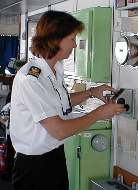 |
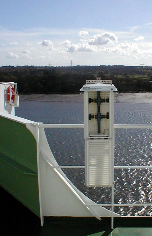
Observer Suzanne Allen, Second Officer checking the pressure using a precision Aneroid Barometer on the RRS Charles Darwin.Photo by H. Gale, PMO |
Gaining a better understanding of the actual observing environment on each participating ship will not only help to improve the overall accuracy of the observations but will, in turn, help to improve the quality of our forecast model outputs. As our operational marine forecasts improve, we will therefore be helping to further ensure the safety of ships, their crews and their cargoes.
The Observer's Contribution
It must be stressed that without the efforts of voluntary observers, submitting quality observations, the project would not exist.
For an observer on a participating VOSClim ship the procedures should appear almost seamless when compared to the procedures for a standard VOS. Each observation transmitted to the National Met Service in near real time is composed in exactly the same format as a standard VOS observation. The difference only occurs with the delayed mode observation data, which requires six additional pieces of information that are not included in the SHIP coded message, namely - the ships heading and speed over the ground at the time of the observation; the relative wind speed and direction; the height of any deck cargo above the ships maximum summer load-line; and the difference between this load-line and the actual sea level. Because electronic logbooks (such as SEAS and TurboWin) have been recommended for use on VOSClim ships, the collection of this additional data is made relatively simple for the observer.
The Port Met Officer's Contribution
The Port Met Officers act as the interface between the observers and the National Meteorological Services and their involvement is also essential to the success of the project.
At the time of recruitment the visiting Port Met Officer will collect all the necessary information about the ship, and the location, type and exposure of its meteorological instruments. This data (known as 'metadata') is essentially the same as that collected for a standard VOS, which is compiled within WMO Publication No 471. However, to support the metadata for VOSClim, the Port Met Officer will additionally take digital photographs of the instruments and arrangements, and prepare ship profile drawings showing the location of the instruments, noting any particular characteristics that might influence the meteorological readings e.g., superstructure overhangs, ships ventilation exhausts that could affect the flow of air through a marine screen, or outflows on the hull that could affect sea temperature measurements.
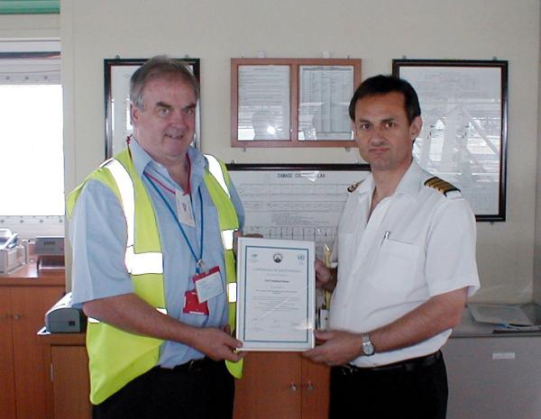 |
PMO Harry Gale presents Captain David Newnes with a VOSClim Certificate. Photo by R. Sturdy 3.O.N. |
The Port Met Officers also help by identifying suitable ships for recruitment. Within the limitations of ships' trading patterns, the aim of the project is to provide global coverage, but at the same time ensuring that candidate ships can be routinely inspected and relied upon to provide regular high quality observations. To encourage representative participation, and to help increase the level of participation, the project aims to obtain observations from as wide a range of observing ship systems as possible, and a number of ships fitted with automatic weather systems are now also included in the VOSClim fleet.
In order to promote the project to potential new ship recruits, the Port Met Officer will usually provide a copy of the explanatory VOSClim project brochure, which has been designed to answer most of the key questions that ship masters and observing officers may have about the participating in the project.
Following recruitment the Port Met Officers aim to inspect VOSClim ships at regular intervals in order to ensure the accuracy of the metadata, and to provide guidance and instruction to observers. During the inspection the Port Met Officers will usually download the additional delayed mode project data from the electronic logbooks and return it to their National Met Service for processing. To recognise the efforts and contribution of observers, the Port Met Officer will also issue each project ship with a VOSClim Certificate of Participation.
The Met Service's Contribution
The National Meteorological Services oversee the project's efficient operation. To ensure that the correct procedures are followed, and that the data is correctly routed, two key processing centres have been established - a Real Time Monitoring Centre (RTMC) and a Data Assembly Centre (DAC). These are located, respectively, at the Met Office (in Exeter, UK) and at the National Climatic Data Center (in Asheville NC, USA). In addition the project also incorporates the services of the two Global Collecting Centres (GCC's) which are already established for the receipt, quality control and dissemination of standard VOS observations. These are located in Hamburg, Germany and Edinburgh, Scotland.
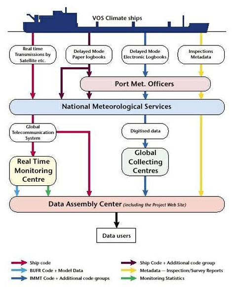 |
Simplified flow diagram showing the routing of VOSClim data |
Upon receipt of each real time observation from a project ship the RTMC appends the six co-located parameters from the Met Office forecast model - pressure, relative humidity, air temperature, sea temperature, wind speed and wind direction. These combined datasets are then transferred to the DAC on a daily basis. In addition the RTMC has responsibility for monitoring the quality of the ship observations against defined criteria, which are set at a tighter level than for standard VOS. These quality monitoring statistics, together with lists of those ships whose observations have failed to meet the required criteria, are then relayed to the DAC and to the national VOSClim focal points in order that any identified problems can be addressed.
Meanwhile minimum quality control procedures are applied to the delayed mode observations that have been collected by the Port Met Officers (and which include the additional project code groups), before they are sent to the GCC's. Having checked the data quality, and clarified any problems bilaterally, the GCC's then send the delayed mode data to the DAC.
All these project data sets, in real and delayed mode format, together with model parameters and the quality monitoring information are then made available for downloading to the scientific community from the project website, which is hosted by the DAC at http://lwf.ncdc.noaa.gov/oa/climate/vosclim/vosclim.html. In addition to acting as a focus for data exchange, the website is also used as the repository for all the essential project information - including up-to-date lists of all participating ships and links to their metadata; the monthly monitoring statistics supplied by the RTMC; and copies of the necessary project documentation and certification.
The Scientist's Contribution
|
Example showing the inside of a well-exposed plastic marine screen installed on VOSClim ship P & O Nedlloyd Manet. Photo by H. Gale, PMO |
The real benefits of the VOSClim data can only be quantified following careful analysis by the scientists and climate researchers who are acting as advisers to the project.
The metadata, for instance, are being used by the scientific advisers in order to quantify the random and systematic errors associated with the ships instruments and observations. In this regard the first scientific paper using the VOSClim data and metadata was recently published in the International Journal of Climatology2. This paper examines the quality of air temperature measurements taken using marine screens. It compares visual assessments of the screen exposures (drawn from photographs taken by Port Met Officers) with statistics of the differences between ship and model air temperatures from the VOSClim model data stream.
As the volume of VOSClim data increases we will be able to increase the scope of the scientific analysis. By making comparisons with forecast model data, and averaging out any problems caused by individual ships or bad forecasts, we should get a clearer overview of the data quality. For instance, the model data has already been used to make bias comparisons with sea temperature measurements from ships using different measurement methods e.g., engine intakes, sea water buckets and hull sensors. The results indicate that sea temperatures from buckets are often colder than those of the model, while sea temperatures from engine intakes and hull sensors are often warmer. This may be due to cooling of the water in the bucket during retrieval, or warming of the intake water by the ships engines.
The Current Status and remaining obstacles
Since the project first went operational at the end of 2001 a total of 139 ships have been recruited (i.e. by June 2005) of which 13 had been withdrawn for various reasons e.g., ship sold or scrapped, changes in owners, trading patterns etc. Nine countries have recruited ships to participate in the project, as shown in the table below.
| Recruiting Country | Total Recruited (since start of project) |
Total Withdrawn (since start of project) |
Total Active (June 2005) |
| Australia | 13 | 3 | 10 |
| Canada | 14 | 0 | 14 |
| France | 7 | 0 | 7 |
| Germany | 11 | 0 | 11 |
| India | 24 | 2 | 22 |
| Japan | 5 | 0 | 5 |
| Netherlands | 1 | 0 | 1 |
| UK | 52 | 8 | 44 |
| US | 12 | 0 | 12 |
| TOTALS | 139 | 13 | 126 |
Unfortunately recruitment is still short of the target figure of a minimum of 200 ships set at the outset of the project - possibly a reflection of the fact that VOS operators are increasingly faced with resource limitations, in some cases leading to reduced PMO numbers. However, it should be noted that the figure of 200 ships was intended as an initial target based upon the recruitment levels originally anticipated by participating countries - and that the overall required level of participation will inevitably need to be revised as a consequence of the scientific assessments currently being undertaken. Participating countries are nevertheless being strongly encouraged to increase their recruitment levels, and several have already pledged to recruit additional ships.
Although the real time and delayed mode data transmission routes to the DAC appear to be operating as planned, there remain some hurdles to overcome. In particular there have been some problems with the flow of the delayed mode data via the GCC's to the project website, partly due to failure by some contributing countries to apply the required minimum quality control standards to the data, or to use the correct data format. As a temporary measure this problem is being overcome by participants providing the raw data from the electronic logbooks directly to the Scientific Advisers. Similarly problems have been experienced due to gaps in the real time and model data flow from the RTMC to the DAC, although action is in hand to recover any lost data.
The Future of VOSClim
At a recent meeting of the Joint WMO/IOC Technical Commission for Oceanography and Marine Meteorology (JCOMM) Ship Observation Team, which now oversees the project's development, it was agreed that the time was right for the project to progress from its 'implementation phase' into an 'evaluation phase'.
During this evaluation phase the Scientific Advisers will assess the 'added-value' of VOSClim data by comparing it with data from the wider VOS. This will allow the identification of which, if any, of the VOSClim project components are acting to improve the quality of VOS data. As a consequence it should then be possible to make recommendations on how to extend the improvements to the wider VOS. Based upon the results of this assessment, a strategy for the future maintenance of the VOSClim high-quality dataset will be developed. A determination will also be made of how many ships and observations are needed to ensure the on-going quality of the dataset, and the value of the additional delayed mode parameters being collected for the project.
To progress this work the Scientific Advisers will also convene an informal 'Scientific Users Group' to widen expertise, and to guide the development, assessment and exploitation of the value of VOSClim dataset. The dataset, which will contain the ship report, model output and delayed mode parameters, will eventually be advertised and made available to users internationally.
As the project becomes increasingly established its profile is being raised in a variety of international forums. For example it will form one of the presentations at the forthcoming Second International Workshop on Advances in the Use of Historical Marine Climate Data (MARCDAT-II), to be held at the Hadley Centre, Exeter, UK, from 17 to 20 October 2005.
The responsibilities of the VOS Climate project management team have now transferred to a new Task Team established to coordinate the projects development. Membership remains essentially the same, and includes representatives of all participating countries, the RTMC, the DAC, the GCC and the Scientific Advisers. Taking full account of the scientific assessment of project data, the Task Team will consider whether VOSClim should remain as a project, or whether it should be developed into a separate long-term operational programme, complementary to the VOS Programme.
Summary
Considerable time and effort has been expended by all the project contributors to ensure the success of VOSClim - which has the potential to enhance the quality of observations over the oceans, while also acting as a model for the wider VOS. As the project now enters its important 'evaluation phase' we hope to prove that this effort has been justified.
Although the essential project procedures are now in place, and the project can be considered as being 'operational,' there nevertheless remain some obstacles to overcome - the biggest priority being to increase the level of recruitment. The goal is to provide a representative subset of the wider VOS rather than to concentrate on ships with sophisticated instrumentation. If they have not already done so, Masters and observers reading this article are therefore encouraged to become involved in the project by contacting their nearest Port Met Officer and volunteering their ships to participate. The suitability of each prospective ship will be considered on its merits.
The impact of climate change is increasingly being brought to our attention, and has become a matter of global concern in recent years. If we are to have confidence in our climate analyses and model predictions we will need higher quality ship data. The VOSClim observation datasets, combined with the associated metadata, will play an important role in fulfilling this need.
References
1. WMO No 47 International List of Voluntary Observing Ships available for download via the WMO website at International List of Voluntary Observing Ships
2. Berry, D. I. and E. C. Kent (2005). The Effect of Instrument Exposure on Marine Air Temperatures: An Assessment Using VOSClim Data International Journal of Climatology, 25 (7), pp.1007-1022.
Page last modified: