The Seventh Leg in the Last Whitbread Round the World Race
Frits Koek, Royal Netherlands Meteorological Institute (KNMI)Images courtesy of Richard Langdon, Ocean Images www.oceanimages.co.uk
Preamble
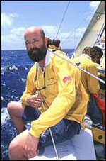
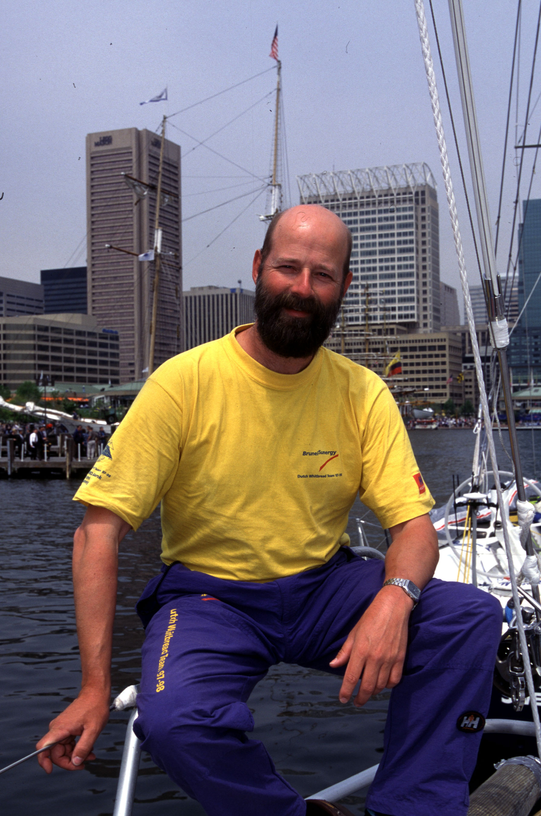
Frits Koek onboard the BrunelSunergy.
Every four years, a number of yachts take part in the Volvo Ocean Race (VOR), previously known as the Whitbread Round The World Race (WRTWR). Around mid-April this year, the yachts of the VOR 2005-2006 will arrive in Baltimore. This time they will come in from the southern hemisphere-Rio de Janeiro was the previous port-instead of what was usually the case, from Fort Lauderdale or Miami. The other difference is that the boats (Volvo-70's) are 10 feet longer and much, much faster than their predecessors, the Volvo-60's (or Whitbread-60's). On the other hand, the maneuverability of the modern yachts in tight places, such as Chesapeake Bay, is challenging.
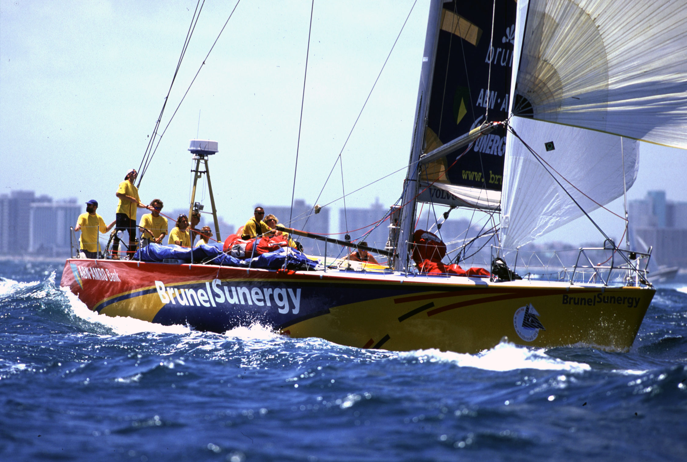
In 1998, in the seventh leg of the WRTWR, the Dutch yacht BrunelSunergy took the first place on the podium. The leg went from Fort Lauderdale to Baltimore, a coastal trip along the American eastern seaboard to the north. On board the contesting yachts, a crew of twelve men usually operate the boats. On this leg, I was recruited as a meteorologist on board the BrunelSunergy. Already, for several months, I was involved in this project, mainly from behind my desk in my office in De Bilt (Royal Netherlands Meteorological Institute, KNMI), but suddenly I was invited to come over and take part in one of the toughest ocean racing sports.
Preparations
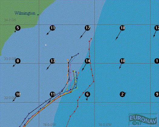
To be prepared for the unexpected, Stuart Quarrie, the navigator on board the BrunelSunergy, and I first went for an explorative trip to the place of arrival, Chesapeake Bay. The bay runs more or less north-south and is approximately 200 km long. The surrounding land is rather flat, and there are many rivers that run into the bay. Our special attention was for current and sea breeze, and we interviewed several local sailors about these phenomena. We even went to the nearest office of the National Weather Service, where we consulted David Feit, now Chief of the Ocean Forecast Branch.
Chesapeake Bay is an area with a semi-diurnal tide, but, due to the outflow of the rivers at certain places the ebb-current is felt predominantly. During a preceding spell with a lot of precipitation in the river basin, a flood current is hardly noticed. About sea breeze, especially in the Annapolis area near Baltimore, we found a practical guide, "The Sailor's Wind," written by a local sailor. The writer divided the sea breeze into three categories: the local pure sea breeze, the Chesapeake's amalgamated sea breeze, and the ocean sea breeze.
An important point to keep in mind when we would arrive in the Bay was the funneling effect of the wind following the rivers on the wind direction in the Bay. Depending on the gradient wind, the wind runs into the mouths of the rivers, or it follows the river into the Bay.
'Back' in Fort Lauderdale, I started collecting forecasts for the sailing area from the European Weather Centre (ECMWF) four days before the start of the leg.
The general idea
Since no contact was allowed between the shore and the ship while they were in the race at sea, we set up a system where KNMI put several forecasts on the web. This was done until the actual start of each leg, so the skipper and/or the navigator of the BrunelSunergy had access to the most recent products tailored to their needs. Apart from these pre-start forecasts, consisting of ECMWF wind and pressure prognoses up to +144 hours, ensemble products and wave forecasts were supplied. Additionally, all yachts received general analyses and forecasts from the race committee during the race.
Whitebread Race Eastern and Western Routes
The weather situation before the start
Already days before the start, which was at noon on Sunday 19 April 1998 in Fort Lauderdale, the midwest and southern regions of the USA suffered from various tornados; the national television paid lots of attention to that. The general weather situation, a day before the start, was described by my colleague Kees Dekker as follows:
The BrunelSynergy takes an easterly route to use the advantage of the winds.
"The center of the Atlantic high near the Azores, with a ridge to the west over Florida, is slowly drifting to the west. Like the previous two days, a low is deepening over the southern states, moving northeast. At Sunday 12:00 UTC the position of the low is over Tennessee. This, together with the west drifting centre of the high, will cause an increasing wind over the east coast. At the start a south-easterly wind, around 15 knots can be expected, but soon the wind will increase to 20-25 knots. The low continues to move to the northeast, expected near Baltimore at Monday 12:00 UTC. The associated cold front will pass Monday between 00:00-06:00 UTC, but there will be a through behind. Winds ahead of the front are stronger than those behind it. There the wind decreases quickly and shifts to directions between north and northeast. The area of high pressure that is building up over the eastern USA will cause a period with light wind speeds over the Chesapeake Bay area. While the high pressure area is moving to the northeast, winds will become more southerly on Wednesday.."
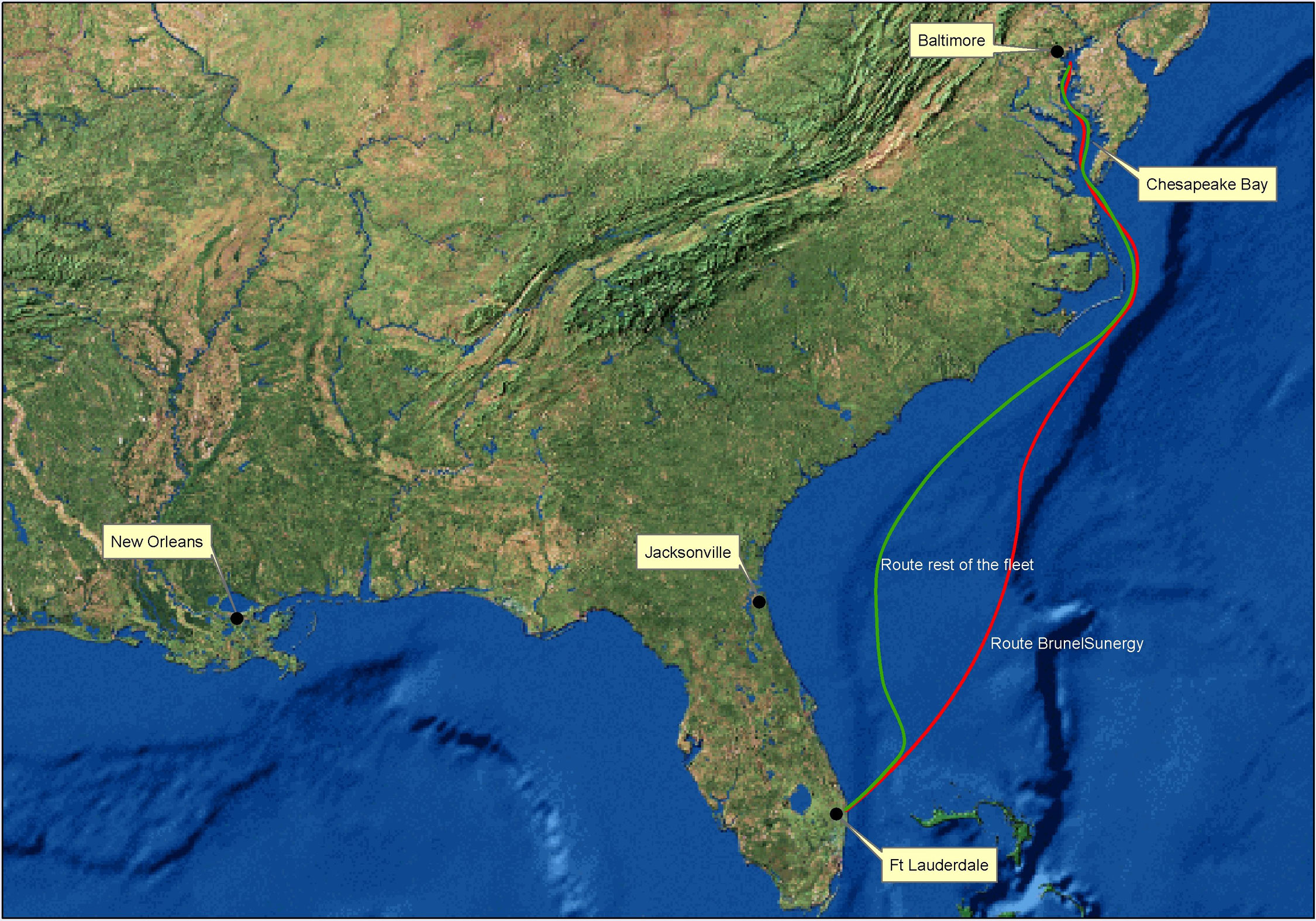
The forecasted situation sketched a picture in which it seemed possible to take advantage of the strong southeasterly winds ahead of the cold front during the first 24 hours. Compared to the westerly route along the coast, which was longer but added 3-4 miles per hour due to the Gulf-stream, the calculated easterly route was faster.
The BrunelSynergy begins crossing the front ahead of the other ships.
On the morning before the start, the new forecast was not consistent with the previous forecasts. Kees described this as follows:
"After being consistent during the last three days, the model decided today, the most important day of the race, to change its ideas. The difference for day one is that the model computes a faster movement of the depression with a more northerly track. The low is now expected near Montreal on Monday around 00:00 UTC. The cold front, that moves faster to the east, is now expected along the Georgian coast on Monday 00:00 UTC and 6 hours later about 150 miles offshore. Meanwhile, an area of high pressure is building over central USA in the wake of the depression. The high pressure area is expected over Cape Hatteras on Tuesday (00:00 UTC). In the +72 hours forecast, a tiny low is developing on Tuesday (00:00 UTC), just north of the Bahamas. Perhaps a wave in the cold front?"
The eastward pace of the cold front was too fast for us to benefit from the favorable wind ahead of it. Our strategy came under pressure.
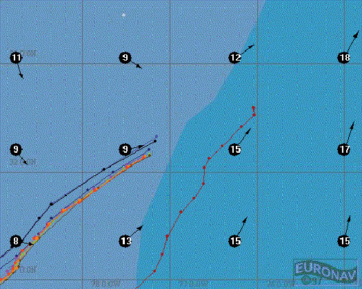
Kees doubted the value of this model run, especially considering the fast northeasterly movement of the depression. Supporting his mistrust, he sent me the +12 hours forecast together with the observations of that same time (Sunday 19 April 00:00 UTC). From this it was clearly visible that the high pressure near Washington was properly forecasted. The low pressure near New Orleans, however, was forecasted to be worse. The actual air pressure on the northeast side of the depression was clearly higher than the forecast led me to believe. This could mean that the pace of the depression was not to be as high as was forecasted, but that it corresponded more with the previous runs. Accordingly, the same applied to the eastward movement of the cold front. Consequently we decided to hold on to our strategy as before.
The pre-start forecast and the possibilities
Bearing in mind Kees' considerations, the forecast did not diverge much from the previous runs. That was most convenient, because we planned our strategy already the evening before the start. Of course, we would have changed our plans, if there had been a significant and reliable change in the forecast, even a few hours before the start.
During the start, a south-southwesterly wind around 15-20 knots was expected. After the start we had to choose to either follow the Gulf-stream or to take the shortest route towards Cape Hatteras. The first option would increase the speed over ground with 2-3 knots, but we had to sail more miles. On the other hand, although shorter, the direct route had some parts in which the Gulf-stream could work against us. Another option was the favorite: the cold front, approaching from the west, provided a stronger wind on the east side than on the west side. The wind direction ahead of the front was better than behind it; winds ahead were southerly and winds behind the front were westerly to northwesterly. Somewhere we had to cross the front, and the choice of that moment was very important. It was expected that we would cross the front sometime on Monday in the afternoon. Provided that the wind did not shift to the north too quickly, it might be possible to sail to Cape Hatteras on one tack. After passing Cape Hatteras, the wind was expected to veer to the east and gradually decrease in speed to around 10-15 knots. In Chesapeake Bay, where we would probably arrive on Tuesday evening, the wind would be southerly, later southwest with 10 knots.
Decisions while underway
The BrunelSynergy tacks towards the Chesapeake Bay.
When, on the first evening after the start, all other competitors decided to go for the Gulf-stream option, I was more or less shocked. Did I miss something that the others had noticed? Over and over I re-calculated what we had to do, and every time I came out with the same solution: we were on the best track. After an intense talk with the skipper, we decided to continue this line. Further along the route, the toughest decision was to determine at what time we would cross the front and move back towards the coast. Ahead of the front we found the forecasted wind. The ship raced through the water. At a certain point the amount of cloudiness near the horizon increased. First, high cirrus, later, the base of the clouds dropped. After the start, no information had been received that this was indeed the expected front. When the line of clouds passed the ship, the wind rotated 360°, it rained, and the wind was very gusty. After this passage, the wind hadn't shifted to the north at all, and I found it extremely difficult to assess our situation without having any observational information from our region. On the western horizon, again clouds appeared and the high cirrus was still there. Most likely we passed a squall line and had the cold front still to come.
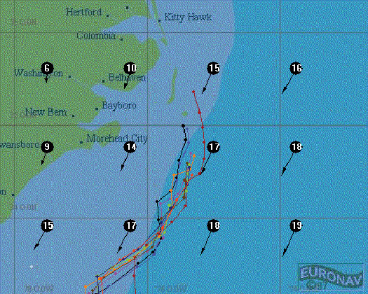
The BrunelSynergy enters the Chesapeake Bay ahead of the other competitors.
And, indeed, the front went by with gusty winds, squalls, thunder and lightning. The wind veered to the northwest and decreased rapidly in speed, which was not ideal. Luckily, as we moved away from the front, the wind veered more, which gave us a better angle, but, unfortunately, this was not enough to reach Cape Hatteras in one go. We had to tack several times, which cost us several valuable miles of our lead. The now northerly to northeasterly wind increased and came from the opposite direction as the Gulf-stream. That caused a nasty situation. The waves, already around 2-3 meters high, became steeper and pounded the ship in a very unpleasant way. In retrospect, the colleagues on board experienced this part as the worst part of the whole race around the world. It was only after the passage of Cape Hatteras that life became more bearable on board.
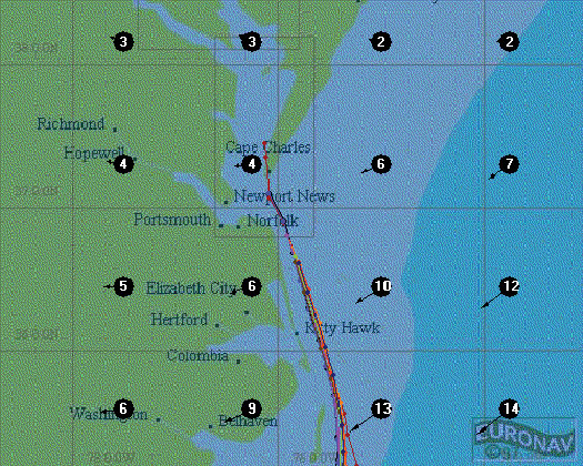
Chesapeake Bay was characterized by light wind and not much current. We entered the bay during slack water, which turned with us into the bay. The yachts behind us had a more favorable flood current of about 1-2 knots. Also, the wind filled the bay again from the south, giving the other boats a better speed. Despite all this, we kept our lead, and, with 15 minutes difference, the BrunelSunergy finished first in this leg. For the first time ever since Connie van Rietschoten (1982), a Dutch yacht triumphed in a leg in the Whitbread Race.
Frits Koek onboard BrunelSynergy in Baltimore Harbor
Remarks
Reviewing this leg, one can question why more ships did not follow the same route as the BrunelSunergy did. There are, however, several reasons:
Using the last ECMWF-run, it was not logical, and the westerly route seemed more profitable;
The 'easterly' route did not benefit much from the Gulf-stream;
In the overall standings the BrunelSunergy did not have much to loose. The other boats were more worried about each other with respect to the ranking and thought: "as long as we can see our rival, they cannot carry out any unexpected moves".