The PMOs Corner
This is the second in a regular series of articles we will be featuring in the Mariners Weather Log. We will be answering questions that you, the ship operators, are interested in. Topics will cover questions that you are asking the PMOs during our visits or through e-mail. If you have a topic or question that you would like to see covered or think others else would benefit from, call or send your PMO an email or you can email VOS @noaa.gov and your question will be considered for an upcoming issue.
I field many questions related to cloud group reporting. How do I tell a low cloud from a mid cloud or a high cloud? What do I do at night when I cant see the clouds? Should I send in an observation that has cloud information that may be wrong?
Being able to read the sky has always been an important ability for the Mariner. Before the introduction of the satellite, the Mariners observation of clouds made it possible for forecasters to find and track the location and movement of fronts over the open ocean. The appearance of a thin veil of high cirrus that moved toward the ship and thickened was the first sign. Then in later observations the reporting of a mid cloud deck indicated a front was approaching and the wind would soon pick up. The appearance of low clouds and precipitation was the final clue that a front was nearby. A special observation (one not on a synoptic time) when the wind shifted would let the forecaster know exactly where and when the front passed the ship. This art of observing the sky is one of the most difficult to master, but still is an effective tool for those at sea to anticipate what will happen to your weather in the short term.
How do I tell a low cloud from a high cloud?
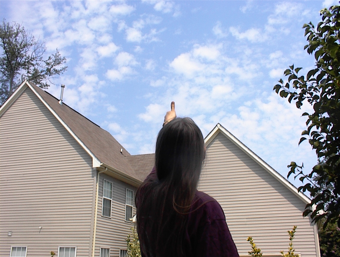
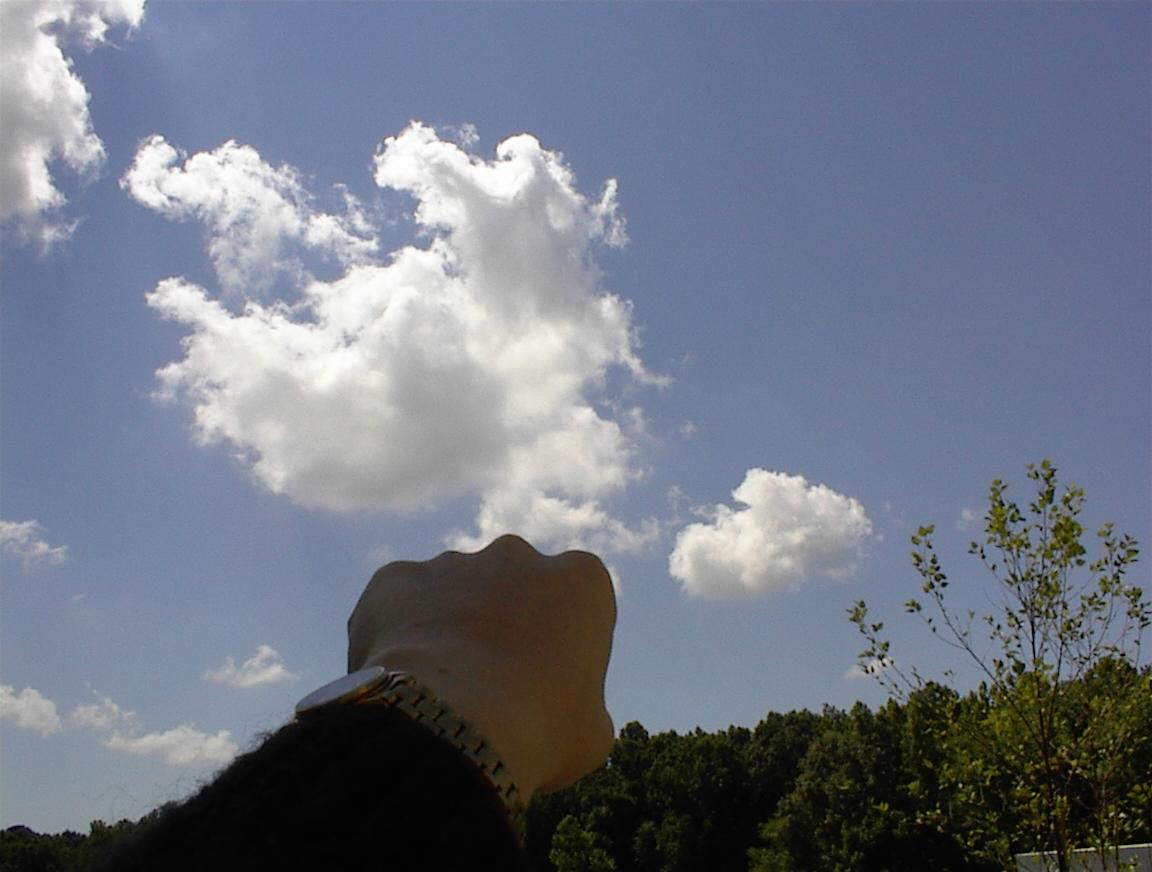
I have a simple method I was taught as a young Naval observer that I would like to share with you. This method works for cumuliform clouds (clouds with detached or rolling cloud elements). Hold your arm extended out in front of your face and look at one element of the cloud you are trying to identify. If it about the size of the nail of your pinky finger it is a high cloud. If the element is about the size of your thumbnail when you hold your hand at arm's length it is a mid cloud. If the element is the size of your entire fist it is a low cloud.
We provide reporting ships with cloud recognition charts to help identify the cloud type. These are guides and they dont cover every type of cloud, but they do give you a general idea. High clouds are composed of suspended ice crystals and are sometimes seen in a hairlike (fibrous) appearance behind a front. Often they appear as a smooth veil that is first seen low on the horizon and later appears to envelope the sky over the ship. This is known as progressively invading the sky. For even the best and most experienced observers reading the sky and identifying clouds is the most difficult part of the observation (followed closely by sea and swell observing). Perfection is not required, nor expected. We only ask that you do your best!
What do I do at night when I cant see the clouds? Should I send in an observation that has cloud information that may be wrong?
If your eyes are not acclimated to the dark it is very difficult to see clouds at night. It is usually best to start the observation by observing clouds first, before you use a light to read temps, wind instruments and pressure equipment. First try to determine how much is covered. If you can see stars that part is clear. If no stars are visible it is overcast or enshrouded by fog. Once you have determined the amount your eyes will be better adjusted to the dark, and you may be able to tell it the cloud is cumuliform or stratiform. It is not cheating to use the last daylight observation as a guide. If the wind and pressure have not changed much since the last observation one can assume that the clouds should be of a similar type. Use the cloud recognition technique above to make sure the clouds deck hasnt lowered, and your finished. Hopefully these tools will make this difficult task a little easier. However, if you are very uncertain about the cloud group and uncomfortable reporting it (possibly in error) just leave the group as soliduss (/////). If you only report the True wind direction and speed, Air and dewpoint temperatures, Sea level pressure and sea water temperature you have provided a wealth of valuable information to the forecaster and model generating software. Please send in observations with the information you can comfortably provide. It will be used!
We (the VOS programme) appreciate your efforts to take high quality weather observations very much. Please keep up the great work! Until the next issue of the MWL, take care!
Jim Luciani
PMO NY/NJ